Our Services
Providing specialized consulting in geotechnical, geospatial, geological, and oceanography engineering solutions.
Geotechnical Engineering
Expert analysis and solutions for soil and foundation stability and integrity.

Geospatial Services
Innovative mapping and spatial analysis for informed decision-making and project planning.
Comprehensive geological assessments and studies for various environmental and construction projects.
Geological Consulting
Hydro-Oceanography Study
Delivering comprehensive oceanography studies, including marine surveys and environmental assessments for coastal projects.
Cadastral services play a crucial role in land management and property ownership. They involve the surveying and mapping of land parcels to establish boundaries and maintain an accurate record of ownership.
Coming Soon
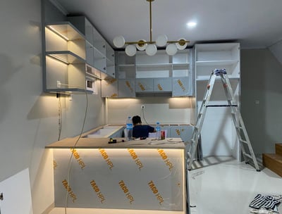
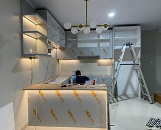
Design Interior and Architecture


Master planning plays a crucial role in orchestrating the various elements of construction, from resource allocation to timeline management, thus minimizing risks and enhancing the efficiency of the process.
Structural and Master Planning
Environmental Study
The analysis of the environmental impact stemming from building construction is a crucial step in sustainable development. This report examines various aspects such as land use, biodiversity loss, water consumption, and carbon emissions associated with new developments.
Our interior design and architecture services focus on transforming spaces to enhance functionality and aesthetics. Whether you’re looking to revamp your home, office, or commercial establishment.
Project Highlights
Explore our diverse projects in geotechnical and geospatial engineering.
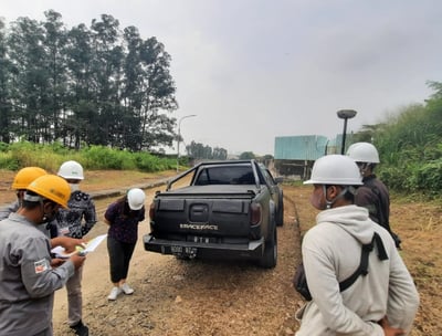
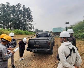
Geotechnical Services
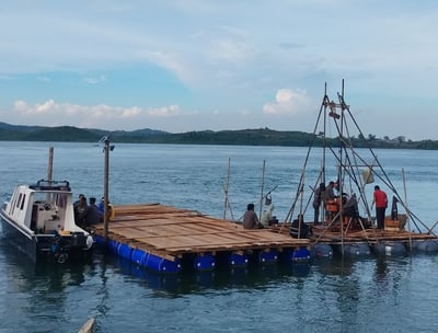
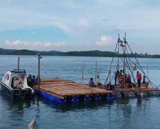
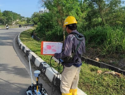
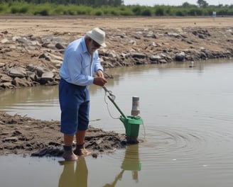
Our team provides expert consultations for geotechnical and Soil Investigation for jetty construction in Batam, for our client Batamindo, are crucial to ensure the structure’s stability and long-term durability. This data supports the design of a robust foundation, accounting for local tidal and environmental conditions. Accurate soil investigation is key to delivering a safe and efficient jetty project for Batamindo.
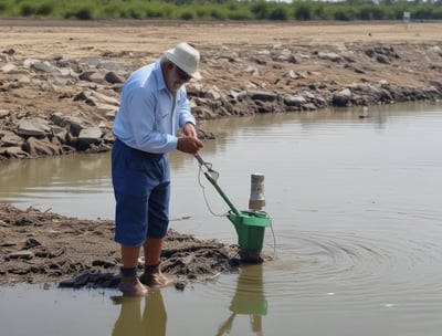
Hydro-Oceanography and Geophysical Survey
We offer innovative solutions in oceanography and engineering for various projects.


Aerial Photogrammetry, LiDAR, and Soil Investigation
We offer innovative solutions in Aerial Photogrammetry for various projects.

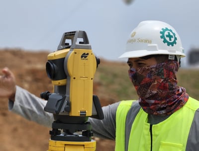
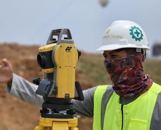
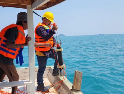
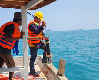
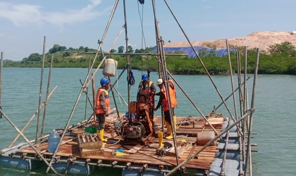
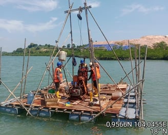
Topography, Hydro Oceanography Study and Soil Investigation for The Planned Coal Loading Jetty
Navitech successfully conducted the Technical Survey (Topography Survey, Bathymetry Survey, Current Observation, and Soil Investigation) for the planned coal loading jetty. We're committed the delivering optimal results at every step of the project and look forward high-quality result for our client.